
Ottawa County topographic map
Interactive map
Click on the map to display elevation.
About this map
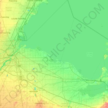
Name: Ottawa County topographic map, elevation, terrain.
Location: Ottawa County, Ohio, United States of America (41.45694 -83.41587 41.86044 -82.61268)
Average elevation: 180 m
Minimum elevation: 162 m
Maximum elevation: 239 m
Other topographic maps
Click on a map to view its topography, its elevation and its terrain.
East Gardens
United States of America > Ohio > Northwood > East Gardens
East Gardens, Northwood, Wood County, Ohio, 43616:43619, United States of America
Average elevation: 188 m
Highland County
United States of America > Ohio
Highland County, Ohio, United States of America
Average elevation: 305 m