
Täby kommun topographic map
Interactive map
Click on the map to display elevation.
About this map
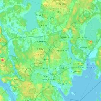
Name: Täby kommun topographic map, elevation, terrain.
Location: Täby kommun, Stockholm County, Region Svealand, Sweden (59.41218 17.98126 59.51116 18.15373)
Average elevation: 21 m
Minimum elevation: -4 m
Maximum elevation: 80 m
Other topographic maps
Click on a map to view its topography, its elevation and its terrain.
Gamla stan
Sweden > Stockholm County > Stockholm
Gamla stan, Södermalms stadsdelsområde, Stockholm, Stockholm County, Region Svealand, Sweden
Average elevation: 19 m
Trångan
Trångan, Norrtälje, Stockholm County, Region Svealand, Sweden
Average elevation: 0 m