
Anini topographic map
Interactive map
Click on the map to display elevation.
About this map
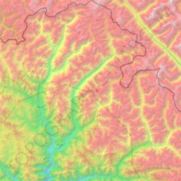
Name: Anini topographic map, elevation, terrain.
Location: Anini, Upper Dibang Valley, Arunachal Pradesh, India (28.64902 95.69999 29.38238 96.30200)
Average elevation: 3,414 m
Minimum elevation: 1,047 m
Maximum elevation: 5,935 m
Other topographic maps
Click on a map to view its topography, its elevation and its terrain.
Seijosa
Seijosa, Pakke-Kessang District, Arunachal Pradesh, India
Average elevation: 566 m