
Red Branch topographic map
Interactive map
Click on the map to display elevation.
About this map
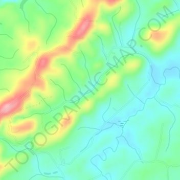
Name: Red Branch topographic map, elevation, terrain.
Location: Red Branch, Monroe County, Tennessee, USA (35.58090 -84.36006 35.58217 -84.35819)
Average elevation: 309 m
Minimum elevation: 262 m
Maximum elevation: 402 m
Other topographic maps
Click on a map to view its topography, its elevation and its terrain.
Great Smoky Mountains National Park
USA > Tennessee > Fort Harry
Great Smoky Mountains National Park, Boulevard Trail, Fort Harry, Sevier County, Tennessee, USA
Average elevation: 765 m
Hill Country
USA > Tennessee > Hill Country
Hill Country, Sullivan County, Tennessee, 37621, USA
Average elevation: 548 m
The Swamps
USA > Tennessee > Mount Denson
The Swamps, Hyde Road, Mount Denson, Robertson County, Tennessee, 37172, USA
Average elevation: 216 m