
Santa Fe topographic map
Interactive map
Click on the map to display elevation.
About this map
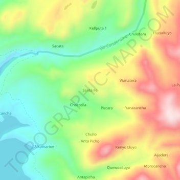
Name: Santa Fe topographic map, elevation, terrain.
Location: Santa Fe, Province of Caylloma, Arequipa, Peru (-15.42446 -71.24635 -15.38446 -71.20635)
Average elevation: 4,358 m
Minimum elevation: 4,191 m
Maximum elevation: 4,581 m