
Tebing Tinggi topographic map
Interactive map
Click on the map to display elevation.
About this map
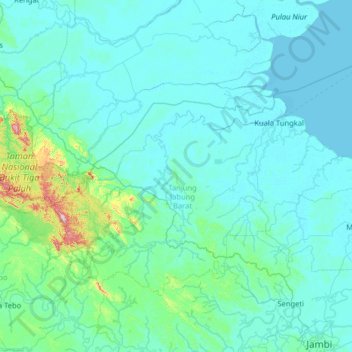
Name: Tebing Tinggi topographic map, elevation, terrain.
Location: Tebing Tinggi, Jambi, Indonesia (-1.66056 102.44515 -0.38056 103.72515)
Average elevation: 40 m
Minimum elevation: -2 m
Maximum elevation: 655 m
Other topographic maps
Click on a map to view its topography, its elevation and its terrain.