
Pulau Sekudu topographic map
Interactive map
Click on the map to display elevation.
About this map
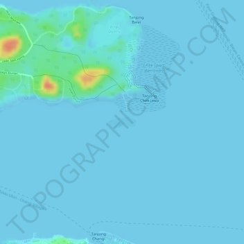
Name: Pulau Sekudu topographic map, elevation, terrain.
Location: Pulau Sekudu, Kampong Ladang, Southeast, Singapore (1.40477 103.98759 1.40608 103.99074)
Average elevation: 3 m
Minimum elevation: -2 m
Maximum elevation: 46 m
Other topographic maps
Click on a map to view its topography, its elevation and its terrain.
Changi Beach Park
Changi Beach Park, Changi Village, Kampong Ladang, Southeast, Singapore
Average elevation: 6 m
Kampong Ladang
Kampong Ladang, Southeast, 498998, Singapore
Average elevation: 9 m
Changi Creek Reservoir
Changi Creek Reservoir, Nicoll Drive, Changi Village, Kampong Ladang, Southeast, 498998, Singapore
Average elevation: 6 m
Pulau Tekong Reservoir
Pulau Tekong Reservoir, Jalan Pasir Merah, Kampong Ladang, Southeast, Singapore
Average elevation: 21 m