
Podgorica topographic map
Interactive map
Click on the map to display elevation.
About this map
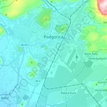
Name: Podgorica topographic map, elevation, terrain.
Location: Podgorica, Podgorica Capital City, Montenegro (42.37909 19.17973 42.47488 19.31406)
Average elevation: 76 m
Minimum elevation: 16 m
Maximum elevation: 574 m
In contrast to most of Montenegro, Podgorica lies in a mainly flat area at the northern end of the Zeta plain, at an elevation of 40 m (130 ft). The only exceptions are hills which overlook the city. The most significant is 130.3 m (427 ft) high Gorica Hill (pronounced ), city's namesake, which rises above the city centre. The other hills include Malo brdo ("little hill", 205.4 m or 674 ft), Velje brdo ("big hill", 283 m or 928 ft), Ljubović (101 m or 331 ft) and Dajbapska gora (172 m or 564 ft). For the most part, these are too steep for development and thus limit the city's expansion, especially to the north. However, urbanization has been encroaching on the lower slopes of the hills since the 1990s. Podgorica city proper has an area of 108 square kilometres (42 sq mi), while actual urbanized area is much smaller.