
Girardot topographic map
Interactive map
Click on the map to display elevation.
About this map
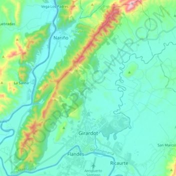
Name: Girardot topographic map, elevation, terrain.
Location: Girardot, Colombia (4.26535 -74.89082 4.43424 -74.73911)
Average elevation: 358 m
Minimum elevation: 232 m
Maximum elevation: 935 m