
Kilkenny topographic map
Interactive map
Click on the map to display elevation.
About this map
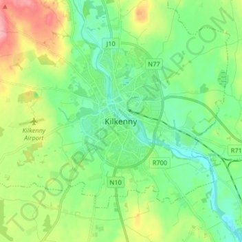
Name: Kilkenny topographic map, elevation, terrain.
Location: Kilkenny, County Kilkenny, Leinster, R95 TC63, Ireland (52.61102 -7.28849 52.69102 -7.20849)
Average elevation: 70 m
Minimum elevation: 34 m
Maximum elevation: 147 m
The elevation is 60 metres (200 ft) above mean sea level. The area of Kilkenny borough is 3.74 square kilometres (1.44 sq mi).