
Kianggeh topographic map
Interactive map
Click on the map to display elevation.
About this map
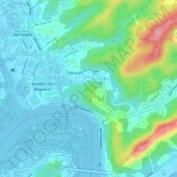
Name: Kianggeh topographic map, elevation, terrain.
Location: Kianggeh, Mukim Kianggeh, Brunei-Muara District, Brunei (4.88351 114.94323 4.89492 114.95342)
Average elevation: 30 m
Minimum elevation: -3 m
Maximum elevation: 126 m
Other topographic maps
Click on a map to view its topography, its elevation and its terrain.