
Beyşehir topographic map
Interactive map
Click on the map to display elevation.
About this map
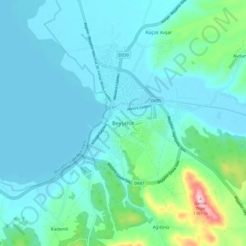
Name: Beyşehir topographic map, elevation, terrain.
Location: Beyşehir, Konya, Central Anatolia Region, Turkey (37.63545 31.68691 37.71545 31.76691)
Average elevation: 1,161 m
Minimum elevation: 1,121 m
Maximum elevation: 1,394 m