
Les topographic map
Interactive map
Click on the map to display elevation.
About this map
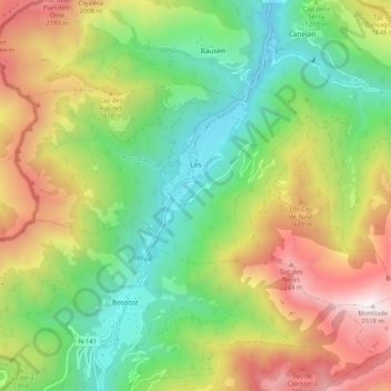
Name: Les topographic map, elevation, terrain.
Location: Les, Val d'Aran, Lleida, Catalonia, 25540, Spain (42.78502 0.66415 42.82837 0.76753)
Average elevation: 1,347 m
Minimum elevation: 592 m
Maximum elevation: 2,504 m