
Berg en Dal topographic map
Interactive map
Click on the map to display elevation.
About this map
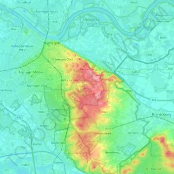
Name: Berg en Dal topographic map, elevation, terrain.
Location: Berg en Dal, Geldern, Niederlande (51.74103 5.87907 51.88167 6.06349)
Average elevation: 23 m
Minimum elevation: 4 m
Maximum elevation: 94 m