
Pinheiro Grande topographic map
Interactive map
Click on the map to display elevation.
About this map
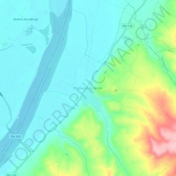
Name: Pinheiro Grande topographic map, elevation, terrain.
Location: Pinheiro Grande, Chamusca, Santarém, 2150-108, Portugal (39.37473 -8.45856 39.41473 -8.41856)
Average elevation: 50 m
Minimum elevation: 8 m
Maximum elevation: 175 m
Other topographic maps
Click on a map to view its topography, its elevation and its terrain.
Casal das Oliveiras
Portugal > Santarém > Chamusca > Vale de Cavalos
Casal das Oliveiras, Vale de Cavalos, Chamusca, Santarém, Portugal
Average elevation: 52 m