
Make a donation
Armutlu topographic map
Click on the map to display elevation.
Make a donation
About this map
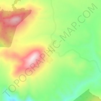
Name: Armutlu topographic map, elevation, terrain.
Location: Armutlu, Konya, Central Anatolia Region, Turkey (37.11623 32.49428 37.15623 32.53428)
Average elevation: 1,478 m
Minimum elevation: 1,232 m
Maximum elevation: 1,771 m
Make a donation
Other topographic maps
Click on a map to view its topography, its elevation and its terrain.
Make a donation
Make a donation
Make a donation
Make a donation
Make a donation
Make a donation
Make a donation
Make a donation
Make a donation
Make a donation
Make a donation
Niksar
Niksar is approximately 9,555 km2 (3,689 sq mi). It is located at 40°35' north latitude and 36°58' east longitude. Its average altitude is 350m above sea level. It is surrounded by Erbaa on the northwest, Tokat on the southwest, Almus on the south, Başçiftlik on the southeast and Akkuş on the north. It is…
Average elevation: 1,009 m
Make a donation
Adıyaman
Adıyaman has a hot summer Mediterranean climate (Csa) under both the Köppen and Trewartha classifications, with some continental characteristics. Summers are very hot and very dry. Temperatures often reach 40 °C (104 °F) at the height of summer. The highest recorded temperature was 45.3 °C (113.5 °F) on…
Average elevation: 814 m
Make a donation
Make a donation
Make a donation
Make a donation
Make a donation
Make a donation
Make a donation
Make a donation
Make a donation
Make a donation
Make a donation
Kırşehir
Kırşehir, formerly Mocissus or as Mokissos (Ancient Greek: Μωκισσός) and Justinianopolis (Ἰουστινιανούπολις), is a city in Turkey. It is the seat of Kırşehir Province and Kırşehir District. Its population is 150,700 (2022). Its elevation is 1,027 m (3,369 ft). The Mayor of Kırşehir is Selahattin Ekicioğlu.
Average elevation: 1,129 m
Make a donation
Pazar
Pazar has plenty of grazing land, including summer grazing in the high mountain pastures (yayla in Turkish) further up the Fırtına River. At even higher altitudes efforts are being made to plant trees but it is hard to put roads through and manage a forest in these steep, high mountains.
Average elevation: 317 m
Make a donation