
Thank you for supporting this site ❤️
Make a donation
Make a donation
Little Rincon Mountains topographic map
Click on the map to display elevation.
Thank you for supporting this site ❤️
Make a donation
Make a donation
About this map
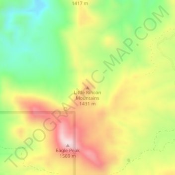
Name: Little Rincon Mountains topographic map, elevation, terrain.
Average elevation: 1,331 m
Minimum elevation: 1,117 m
Maximum elevation: 1,564 m
Thank you for supporting this site ❤️
Make a donation
Make a donation
Other topographic maps
Click on a map to view its topography, its elevation and its terrain.
Thank you for supporting this site ❤️
Make a donation
Make a donation
Kartchner Caverns State Park
United States > Arizona > Cochise County > Benson
Average elevation: 1,432 m