
Thank you for supporting this site ❤️
Make a donation
Make a donation
Grauspitz topographic map
Click on the map to display elevation.
Thank you for supporting this site ❤️
Make a donation
Make a donation
About this map
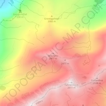
Name: Grauspitz topographic map, elevation, terrain.
Location: Grauspitz, Mels, Wahlkreis Sarganserland, Saint-Gall, Suisse (46.94962 9.28619 46.94972 9.28629)
Average elevation: 2,139 m
Minimum elevation: 1,397 m
Maximum elevation: 2,581 m
Thank you for supporting this site ❤️
Make a donation
Make a donation
Other topographic maps
Click on a map to view its topography, its elevation and its terrain.