
Altai Mountains topographic map
Interactive map
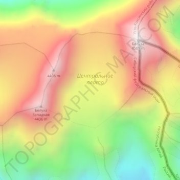
Click on the map to display elevation.
About this map
Name: Altai Mountains topographic map, elevation, terrain.
Average elevation: 3,269 m
Minimum elevation: 2,769 m
Maximum elevation: 3,914 m
Other topographic maps
Click on a map to view its topography, its elevation and its terrain.
Таван-Богдо-Ула / Таван богд / 奎屯峰
Russia > Altai Republic > Джазаторское сельское поселение
Таван-Богдо-Ула / Таван богд / 奎屯峰, Джазаторское сельское поселение, Kosh-Agachsky Rayon, Altai Republic, Siberian Federal District, Russia
Average elevation: 3,775 m