
Thank you for supporting this site ❤️
Make a donation
Make a donation
Naurikot topographic map
Click on the map to display elevation.
Thank you for supporting this site ❤️
Make a donation
Make a donation
About this map
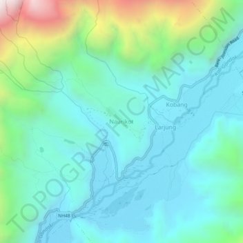
Name: Naurikot topographic map, elevation, terrain.
Location: Naurikot, Thasang, मुस्ताङ, गण्डकी प्रदेश, Nepal (28.66742 83.58654 28.70742 83.62654)
Average elevation: 2,823 m
Minimum elevation: 2,519 m
Maximum elevation: 3,933 m
Thank you for supporting this site ❤️
Make a donation
Make a donation
Other topographic maps
Click on a map to view its topography, its elevation and its terrain.