
Butte topographic map
Interactive map
Click on the map to display elevation.
About this map
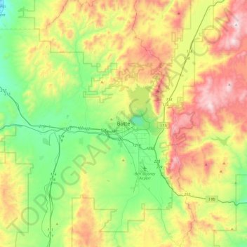
Name: Butte topographic map, elevation, terrain.
Location: Butte, Montana, 59701, États-Unis d'Amérique (45.85315 -112.69651 46.17315 -112.37651)
Average elevation: 1,920 m
Minimum elevation: 1,469 m
Maximum elevation: 2,657 m
Other topographic maps
Click on a map to view its topography, its elevation and its terrain.
Butte
États-Unis d'Amérique > Montana > Butte
Butte, Silver Bow County, Montana, États-Unis d'Amérique
Average elevation: 1,909 m