
Thank you for supporting this site ❤️
Make a donation
Make a donation
Ban Khlong Ple topographic map
Click on the map to display elevation.
Thank you for supporting this site ❤️
Make a donation
Make a donation
About this map
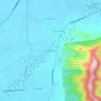
Name: Ban Khlong Ple topographic map, elevation, terrain.
Location: Ban Khlong Ple, Kho Hong, Hat Yai, Songkhla Province, Thailand (7.02480 100.48140 7.06480 100.52140)
Average elevation: 45 m
Minimum elevation: -1 m
Maximum elevation: 327 m
Thank you for supporting this site ❤️
Make a donation
Make a donation