Sarchu topographic map
Interactive map
Click on the map to display elevation.
About this map
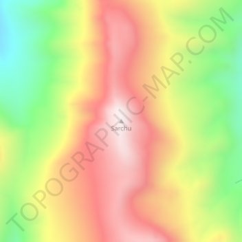
Name: Sarchu topographic map, elevation, terrain.
Location: Sarchu, Lahul, Lahul and Spiti, Himachal Pradesh, India (32.81546 77.53250 32.81556 77.53260)
Average elevation: 5,408 m
Minimum elevation: 5,015 m
Maximum elevation: 5,746 m
Other topographic maps
Click on a map to view its topography, its elevation and its terrain.
Yamling
India > Himachal Pradesh > Lahul
Yamling, Lahul, Lahaul and Spiti District, Himachal Pradesh, India
Average elevation: 3,420 m
Rohtang Pass
India > Himachal Pradesh > Lahul
Rohtang Pass, Lahul, Lahul and Spiti, Himachal Pradesh, India
Average elevation: 4,042 m
Bara Shigri Glacier
India > Himachal Pradesh > Lahul
Bara Shigri Glacier, Lahul, Lahul and Spiti, Himachal Pradesh, India
Average elevation: 5,369 m
Baralacha Pass
India > Himachal Pradesh > Lahul
Baralacha Pass, Lahul, Lahul and Spiti, Himachal Pradesh, India
Average elevation: 4,983 m
Lahul
India > Himachal Pradesh > Lahul
Lahul, Lahul and Spiti, Himachal Pradesh, India
Average elevation: 4,551 m
Keylang
India > Himachal Pradesh > Lahul > Keylang
Keylang, Lahul, Lahul and Spiti, Himachal Pradesh, 175132, India
Average elevation: 3,827 m