
Thank you for supporting this site ❤️
Make a donation
Make a donation
Panongan Lor topographic map
Click on the map to display elevation.
Thank you for supporting this site ❤️
Make a donation
Make a donation
About this map
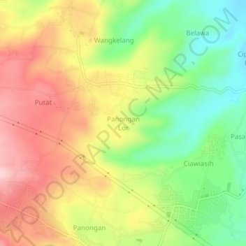
Name: Panongan Lor topographic map, elevation, terrain.
Location: Panongan Lor, Cirebon, West Java, Java, 45189, Indonesia (-6.85980 108.56204 -6.81980 108.60204)
Average elevation: 138 m
Minimum elevation: 29 m
Maximum elevation: 250 m
Thank you for supporting this site ❤️
Make a donation
Make a donation