
Devils Tower topographic map
Interactive map
Click on the map to display elevation.
About this map
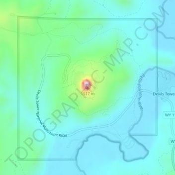
Name: Devils Tower topographic map, elevation, terrain.
Average elevation: 1,236 m
Minimum elevation: 1,170 m
Maximum elevation: 1,547 m
Other topographic maps
Click on a map to view its topography, its elevation and its terrain.
Albany County
United States of America > Wyoming
Albany County, Wyoming, United States of America
Average elevation: 2,138 m
Hot Springs County
United States of America > Wyoming
Hot Springs County, Wyoming, United States of America
Average elevation: 1,745 m