
Devant Staneux topographic map
Interactive map
Click on the map to display elevation.
About this map
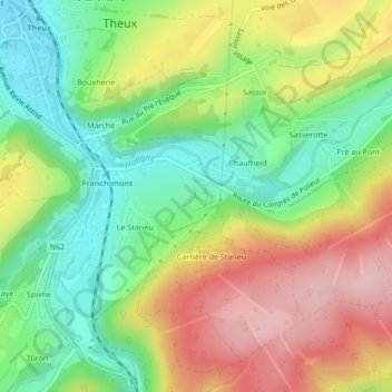
Name: Devant Staneux topographic map, elevation, terrain.
Location: Devant Staneux, Theux, Liège, Wallonie, 4910, Belgique (50.51392 5.82208 50.53392 5.84208)
Average elevation: 252 m
Minimum elevation: 159 m
Maximum elevation: 370 m
Other topographic maps
Click on a map to view its topography, its elevation and its terrain.
Parc Ménobu
Belgique > Wallonie > Theux > Parc Ménobu
Parc Ménobu, La Reid, Theux, Liège, Wallonie, 4910, Belgique
Average elevation: 324 m
Porte de Fer
Porte de Fer, La Reid, Theux, Verviers, Liège, Wallonie, 4910, Belgique
Average elevation: 356 m