
Make a donation
Hanish topographic map
Click on the map to display elevation.
Make a donation
About this map
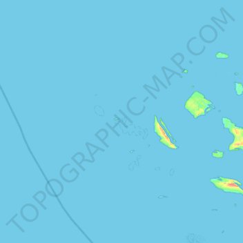
Name: Hanish topographic map, elevation, terrain.
Location: Hanish, Farasan, Saudi Arabia (16.56230 41.15773 17.20230 41.79773)
Average elevation: 0 m
Minimum elevation: -1 m
Maximum elevation: 61 m
Make a donation
Other topographic maps
Click on a map to view its topography, its elevation and its terrain.
Arabian Peninsula
Arabia has few lakes or permanent rivers. Most areas are drained by ephemeral watercourses called wadis, which are dry except during the rainy season. Plentiful ancient aquifers exist beneath much of the peninsula, however, and where this water surfaces, oases form (e.g. Al-Hasa and Qatif, two of the world's…
Average elevation: 544 m
Arabian Peninsula
In general, the climate is extremely hot and arid, although there are exceptions. Higher elevations are made temperate by their altitude, and the Arabian Sea coastline can receive cool, humid breezes in summer due to cold upwelling offshore. The peninsula has no thick forests. Desert-adapted wildlife is…
Average elevation: 544 m
Arabian Peninsula
Arabia has few lakes or permanent rivers. Most areas are drained by ephemeral watercourses called wadis, which are dry except during the rainy season. Plentiful ancient aquifers exist beneath much of the peninsula, however, and where this water surfaces, oases form (e.g. Al-Hasa and Qatif, two of the world's…
Average elevation: 544 m
Make a donation
Rub‘ al Khali
The desert is 1,000 kilometres (620 miles) long, and 500 kilometres (310 miles) wide. Its surface elevation varies from 800 metres (2,600 ft) in the southwest to around sea level in the northeast. Most of the terrain is ergs, with sand dunes up to 250 metres (820 ft) high, interspersed with gravel and gypsum…
Average elevation: 332 m
Make a donation
Rabigh
Rabigh (Arabic: رَابِغ, romanized: Rābigh) is a city and governorate in the Province of Makkah of the Kingdom of Saudi Arabia, situated on the coast of the Red Sea, around 208 km (129 miles) northwest of Mecca in the historic Hejazi region. The city had an estimated population of 180,352 in 2014 and is…
Average elevation: 145 m
Make a donation
Make a donation
Make a donation
Make a donation
Make a donation
Make a donation
Make a donation
Make a donation
Make a donation
Make a donation
Make a donation
Make a donation
Make a donation
Make a donation
Make a donation
Make a donation
Make a donation
Make a donation
Make a donation
Make a donation
Make a donation
Make a donation