
Thank you for supporting this site ❤️
Make a donation
Make a donation
Tomarata topographic map
Click on the map to display elevation.
Thank you for supporting this site ❤️
Make a donation
Make a donation
About this map
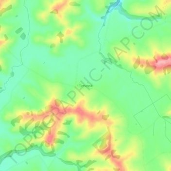
Name: Tomarata topographic map, elevation, terrain.
Location: Tomarata, Rodney, Auckland, 0974, New Zealand (-36.25121 174.61537 -36.21121 174.65537)
Average elevation: 85 m
Minimum elevation: 33 m
Maximum elevation: 165 m
Thank you for supporting this site ❤️
Make a donation
Make a donation
Other topographic maps
Click on a map to view its topography, its elevation and its terrain.