
Thank you for supporting this site ❤️
Make a donation
Make a donation
Huijipata topographic map
Click on the map to display elevation.
Thank you for supporting this site ❤️
Make a donation
Make a donation
About this map
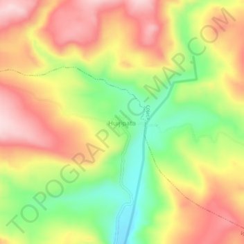
Name: Huijipata topographic map, elevation, terrain.
Location: Huijipata, Vilque Chico, Huancané, Puno, Perú (-15.07165 -69.56609 -15.03165 -69.52609)
Average elevation: 4,237 m
Minimum elevation: 4,080 m
Maximum elevation: 4,377 m
Thank you for supporting this site ❤️
Make a donation
Make a donation