
l'Aleixar topographic map
Interactive map
Click on the map to display elevation.
About this map
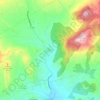
Name: l'Aleixar topographic map, elevation, terrain.
Location: l'Aleixar, Bajo Campo, Tarragona, Cataluña, 43381, España (41.18125 1.02669 41.22125 1.06669)
Average elevation: 329 m
Minimum elevation: 194 m
Maximum elevation: 566 m