
Thank you for supporting this site ❤️
Make a donation
Make a donation
Rwene topographic map
Click on the map to display elevation.
Thank you for supporting this site ❤️
Make a donation
Make a donation
About this map
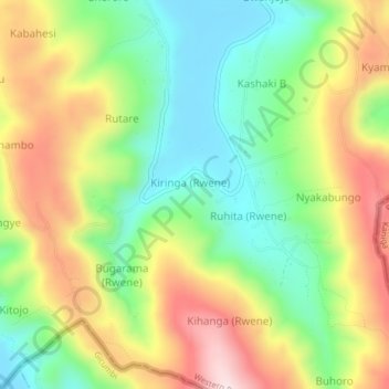
Name: Rwene topographic map, elevation, terrain.
Location: Rwene, Kabale, Western Region, Uganda (-1.42000 30.01333 -1.38000 30.05333)
Average elevation: 1,990 m
Minimum elevation: 1,803 m
Maximum elevation: 2,241 m
Thank you for supporting this site ❤️
Make a donation
Make a donation
Other topographic maps
Click on a map to view its topography, its elevation and its terrain.