
Thank you for supporting this site ❤️
Make a donation
Make a donation
Midway topographic map
Click on the map to display elevation.
Thank you for supporting this site ❤️
Make a donation
Make a donation
About this map
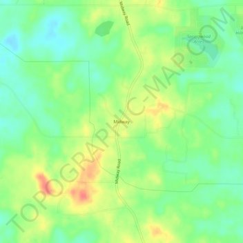
Name: Midway topographic map, elevation, terrain.
Location: Midway, Hinds County, Mississippi, United States (32.14904 -90.39565 32.18904 -90.35565)
Average elevation: 112 m
Minimum elevation: 90 m
Maximum elevation: 142 m
Thank you for supporting this site ❤️
Make a donation
Make a donation
Other topographic maps
Click on a map to view its topography, its elevation and its terrain.
Lake Catherine
United States > Mississippi > Hinds County > Jackson > Lost Lake
Average elevation: 100 m
Thank you for supporting this site ❤️
Make a donation
Make a donation