
Thank you for supporting this site ❤️
Make a donation
Make a donation
Kahnuj topographic map
Click on the map to display elevation.
Thank you for supporting this site ❤️
Make a donation
Make a donation
Kahnuj
The elevation of Kahnuj is 5.5 meters above sea level. The Beshagard Mountains, a section of the Zagros Mountains that extend towards Jazmourian and divide Kahnuj from Hormozgan Province, are situated in this county's mountainous region. In general, Kahnuj has a hot climate. Although precipitation is rare, it can occasionally take the form of torrential rain.
Thank you for supporting this site ❤️
Make a donation
Make a donation
About this map
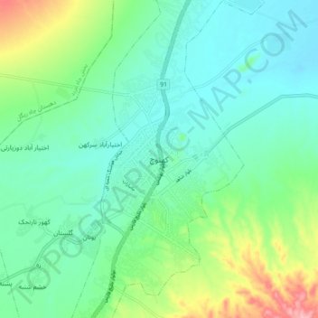
Name: Kahnuj topographic map, elevation, terrain.
Average elevation: 520 m
Minimum elevation: 481 m
Maximum elevation: 631 m
Thank you for supporting this site ❤️
Make a donation
Make a donation