
Ship Rock topographic map
Interactive map
Click on the map to display elevation.
About this map
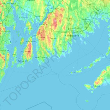
Name: Ship Rock topographic map, elevation, terrain.
Average elevation: 9 m
Minimum elevation: -12 m
Maximum elevation: 104 m
Other topographic maps
Click on a map to view its topography, its elevation and its terrain.
Horseneck Beach
USA > Massachusetts > Westport
Horseneck Beach, Cherry and Webb Lane, Westport, Bristol County, Massachusetts, 02791, USA
Average elevation: 0 m