
Thank you for supporting this site ❤️
Make a donation
Make a donation
Alleur topographic map
Click on the map to display elevation.
Thank you for supporting this site ❤️
Make a donation
Make a donation
About this map
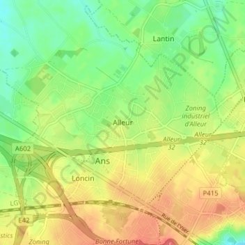
Name: Alleur topographic map, elevation, terrain.
Location: Alleur, Ans, Liège, Wallonie, 4430, Belgique (50.65425 5.49299 50.69425 5.53299)
Average elevation: 169 m
Minimum elevation: 143 m
Maximum elevation: 196 m
Thank you for supporting this site ❤️
Make a donation
Make a donation
Other topographic maps
Click on a map to view its topography, its elevation and its terrain.