
Thank you for supporting this site ❤️
Make a donation
Make a donation
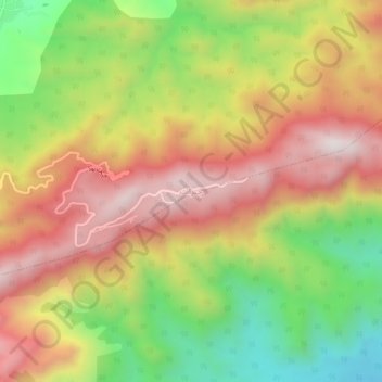
Cherat topographic map
Click on the map to display elevation.
Thank you for supporting this site ❤️
Make a donation
Make a donation
Cherat
Cherat (Pashto: چېراټ) is a hill station dating from the 1860s that is located immediately above the villages of Chapri,Bakhti, Saleh Khana, Kotli Kalan and Dak Ismail Khel in the Nowshera District of Khyber-Pakhtunkhwa in Pakistan. Cherat lies 34 miles south east from the city of Peshawar at an elevation of 4,500 feet on the west of the Khattak range, which divides the district of Nowshera from Kohat District.
Thank you for supporting this site ❤️
Make a donation
Make a donation
About this map
Name: Cherat topographic map, elevation, terrain.
Average elevation: 986 m
Minimum elevation: 553 m
Maximum elevation: 1,380 m
Thank you for supporting this site ❤️
Make a donation
Make a donation