
Thank you for supporting this site ❤️
Make a donation
Make a donation
Saint-Éphrem-de-Beauce topographic map
Click on the map to display elevation.
Thank you for supporting this site ❤️
Make a donation
Make a donation
About this map
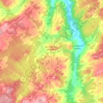
Name: Saint-Éphrem-de-Beauce topographic map, elevation, terrain.
Average elevation: 315 m
Minimum elevation: 211 m
Maximum elevation: 410 m
Thank you for supporting this site ❤️
Make a donation
Make a donation
Other topographic maps
Click on a map to view its topography, its elevation and its terrain.
Saint-Éphrem-Station
Canada > Quebec > Beauce-Sartigan > Saint-Éphrem-de-Beauce
Average elevation: 277 m