
Windsor topographic map
Interactive map
Click on the map to display elevation.
About this map
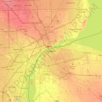
Name: Windsor topographic map, elevation, terrain.
Location: Windsor, Southwestern Ontario, Ontario, N8X 3L9, Canadá (42.14423 -83.18986 42.46423 -82.86986)
Average elevation: 185 m
Minimum elevation: 139 m
Maximum elevation: 217 m