
永丰镇 topographic map
Interactive map
Click on the map to display elevation.
About this map
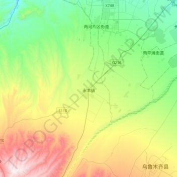
Name: 永丰镇 topographic map, elevation, terrain.
Location: 永丰镇, 乌鲁木齐县, 乌鲁木齐市, 新疆维吾尔自治区, 830000, 中国 (43.49278 87.20638 43.72354 87.38276)
Average elevation: 1,416 m
Minimum elevation: 1,035 m
Maximum elevation: 2,143 m
Other topographic maps
Click on a map to view its topography, its elevation and its terrain.