
Tyczyn topographic map
Interactive map
Click on the map to display elevation.
About this map
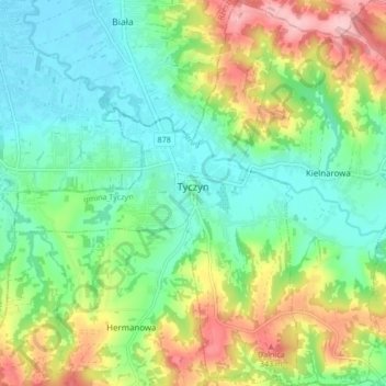
Name: Tyczyn topographic map, elevation, terrain.
Average elevation: 260 m
Minimum elevation: 205 m
Maximum elevation: 365 m
Other topographic maps
Click on a map to view its topography, its elevation and its terrain.
Jasionka
Poland > Subcarpathian Voivodeship > Rzeszów County > Jasionka
Jasionka, gmina Trzebownisko, Rzeszów County, Subcarpathian Voivodeship, Poland
Average elevation: 205 m