
Thank you for supporting this site ❤️
Make a donation
Make a donation
Sainte-Anne topographic map
Click on the map to display elevation.
Thank you for supporting this site ❤️
Make a donation
Make a donation
About this map
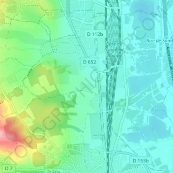
Name: Sainte-Anne topographic map, elevation, terrain.
Average elevation: 183 m
Minimum elevation: 156 m
Maximum elevation: 280 m
Thank you for supporting this site ❤️
Make a donation
Make a donation
Other topographic maps
Click on a map to view its topography, its elevation and its terrain.
Ouvrage des Carrières d'Amanvillers
France > Grand Est > Moselle > Norroy-le-Veneur
Average elevation: 331 m