
Thank you for supporting this site ❤️
Make a donation
Make a donation
Altona topographic map
Click on the map to display elevation.
Thank you for supporting this site ❤️
Make a donation
Make a donation
Altona
The hamlet of Altona is located in the northern part of the town of Altona at 44°53′24″N 73°39′9″W / 44.89000°N 73.65250°W / 44.89000; -73.65250 (44.890096, -73.65272). The Great Chazy River flows along the southeastern edge of the hamlet, dropping 150 feet (46 m) in elevation in 1.7 miles (2.7 km). The Ganienkeh Community of the Mohawk people is southwest of the hamlet.
Thank you for supporting this site ❤️
Make a donation
Make a donation
About this map
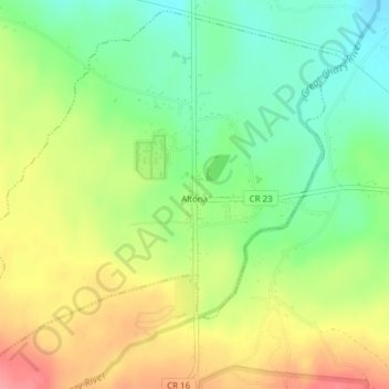
Name: Altona topographic map, elevation, terrain.
Average elevation: 196 m
Minimum elevation: 157 m
Maximum elevation: 243 m
Thank you for supporting this site ❤️
Make a donation
Make a donation