
Thank you for supporting this site ❤️
Make a donation
Make a donation
Arpette topographic map
Click on the map to display elevation.
Thank you for supporting this site ❤️
Make a donation
Make a donation
About this map
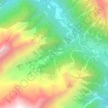
Name: Arpette topographic map, elevation, terrain.
Location: Arpette, Orsières, Entremont, Valais, 2303, Suisse (46.00953 7.06957 46.04953 7.10957)
Average elevation: 1,910 m
Minimum elevation: 1,230 m
Maximum elevation: 2,889 m
Thank you for supporting this site ❤️
Make a donation
Make a donation