
Thank you for supporting this site ❤️
Make a donation
Make a donation
Dyer topographic map
Click on the map to display elevation.
Thank you for supporting this site ❤️
Make a donation
Make a donation
About this map
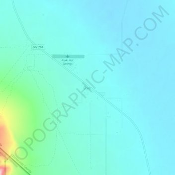
Name: Dyer topographic map, elevation, terrain.
Location: Dyer, Esmeralda County, Nevada, United States (37.64778 -118.08750 37.68778 -118.04750)
Average elevation: 1,494 m
Minimum elevation: 1,464 m
Maximum elevation: 1,686 m
Thank you for supporting this site ❤️
Make a donation
Make a donation
Other topographic maps
Click on a map to view its topography, its elevation and its terrain.