
Thank you for supporting this site ❤️
Make a donation
Make a donation
Buffalo Grove topographic map
Click on the map to display elevation.
Thank you for supporting this site ❤️
Make a donation
Make a donation
About this map
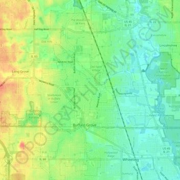
Name: Buffalo Grove topographic map, elevation, terrain.
Location: Buffalo Grove, Lake County, Illinois, United States (42.12975 -87.99499 42.21033 -87.90977)
Average elevation: 209 m
Minimum elevation: 192 m
Maximum elevation: 237 m
Thank you for supporting this site ❤️
Make a donation
Make a donation
Other topographic maps
Click on a map to view its topography, its elevation and its terrain.
Thank you for supporting this site ❤️
Make a donation
Make a donation
Thank you for supporting this site ❤️
Make a donation
Make a donation
Bishops Ridge
United States > Illinois > Lake County > Kildeer > Bishops Ridge
Average elevation: 253 m
Thank you for supporting this site ❤️
Make a donation
Make a donation
Lake Naomi
United States > Illinois > Lake County > Hawthorn Woods > White Birch Lakes
Average elevation: 261 m