
Ophasselt topographic map
Interactive map
Click on the map to display elevation.
About this map
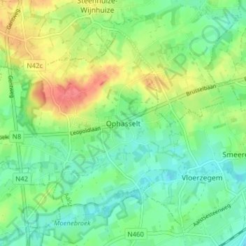
Name: Ophasselt topographic map, elevation, terrain.
Location: Ophasselt, Geraardsbergen, Aalst, East Flanders, 9506, Belgium (50.80186 3.87704 50.84186 3.91704)
Average elevation: 38 m
Minimum elevation: 16 m
Maximum elevation: 76 m
Other topographic maps
Click on a map to view its topography, its elevation and its terrain.
Moerbeke
Belgium > East Flanders > Aalst > Geraardsbergen
Moerbeke, Geraardsbergen, Aalst, East Flanders, Flanders, Belgium
Average elevation: 41 m