
Lundy topographic map
Interactive map
Click on the map to display elevation.
About this map
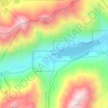
Name: Lundy topographic map, elevation, terrain.
Location: Lundy, Mono County, California, USA (38.00742 -119.26154 38.04742 -119.22154)
Average elevation: 2,882 m
Minimum elevation: 2,370 m
Maximum elevation: 3,509 m