
Thank you for supporting this site ❤️
Make a donation
Make a donation
Phan Dung topographic map
Click on the map to display elevation.
Thank you for supporting this site ❤️
Make a donation
Make a donation
About this map
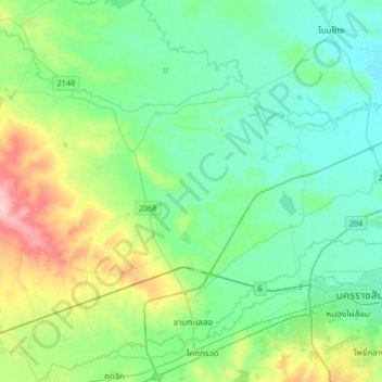
Name: Phan Dung topographic map, elevation, terrain.
Location: Phan Dung, Nakhon Ratchasima Province, Thailand (14.90208 101.78942 15.22208 102.10942)
Average elevation: 202 m
Minimum elevation: 169 m
Maximum elevation: 304 m
Thank you for supporting this site ❤️
Make a donation
Make a donation