
Thank you for supporting this site ❤️
Make a donation
Make a donation
Santos topographic map
Click on the map to display elevation.
Thank you for supporting this site ❤️
Make a donation
Make a donation
About this map
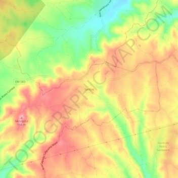
Name: Santos topographic map, elevation, terrain.
Location: Santos, Azoia de Cima e Tremês, Santarém, 2000-433, Portugal (39.35484 -8.73398 39.39484 -8.69398)
Average elevation: 118 m
Minimum elevation: 51 m
Maximum elevation: 167 m
Thank you for supporting this site ❤️
Make a donation
Make a donation
Other topographic maps
Click on a map to view its topography, its elevation and its terrain.