
Thank you for supporting this site ❤️
Make a donation
Make a donation
Sungai Jamari topographic map
Click on the map to display elevation.
Thank you for supporting this site ❤️
Make a donation
Make a donation
About this map
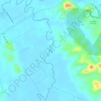
Name: Sungai Jamari topographic map, elevation, terrain.
Location: Sungai Jamari, Mersing, Johor, Malaysia (2.40843 103.81634 2.40945 103.81710)
Average elevation: 10 m
Minimum elevation: 1 m
Maximum elevation: 57 m
Thank you for supporting this site ❤️
Make a donation
Make a donation
Other topographic maps
Click on a map to view its topography, its elevation and its terrain.